
Collection Gems: November 2020
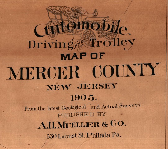
Map 67 is quaint, for lack of a better word. It shows the existing road network for both wagons and automobiles – a fairly new invention in 1905 – and the rails on which ran the trolleys serving Mercer County. According to the US Department of Transportation there were less than 78,000 registered vehicles in the United States in 1905. Good roads were a major issue and improvements were requested by many Americans. One of the wonderful features on the title block (Figure 1) is an image of one such early automobile. It would be great if I knew what model that was, but beyond the fact that it was a 4-seat model with no roof, I can’t say much other than… isn’t that neat?

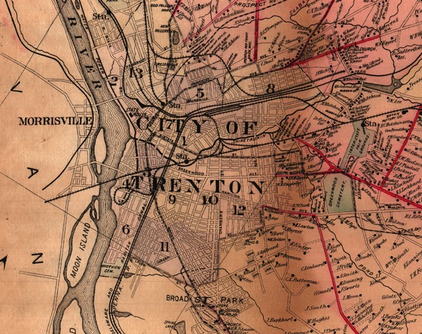
It’s also noteworthy to see the Trenton & Pennington Trolley (Figure 2), and the “Macadamised” roads (colored red). No doubt these were major thoroughfares that brought Hunterdon County residents into a major metropolitan area. If one took the trolley from Pennington to its terminus, a short walk would bring you to the State House (see Figure 3), a significant landmark not just in New Jersey, but in the United States! Built in 1790, it is the third-oldest state house in continuous legislative use in the United States; only the Maryland State Capitol in Annapolis and the Virginia State Capitol in Richmond are older. If you were visiting during Fair season, the Interstate Fair Grounds would be a short train ride away into the suburbs in what is now Hamilton Township.
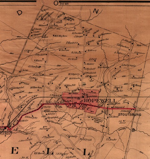
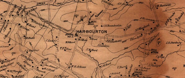
Many small Trenton cemeteries are shown. On a modern map (SSW of Greenwood) Holy Sepulchre and Our Lady of Lourdes are shown in this area. Were the smaller cemeteries merged into the larger, modern day ones? This got me looking at Hopewell (Figure 4). Curiously, neither the Hopewell Baptist House Cemetery on Main Street (final resting place of Signer John Hart) , nor the Stoutsburg African American Cemetery (final resting place of many of the area’s early African-American residents) are shown. The Baptist Church cemetery in Harbourton is also not shown (Figure 5). The lack of mapped cemeteries doesn’t appear to be a problem for Trenton but I suppose since this is a “Driving and Trolley Map…” it was less important to locate burial grounds in small towns. How were they to know that driving accidents would cause 35,000 to 40,000 deaths per year in 21st Century America and roads capable of supporting high speed traffic would not be limited to major cities?
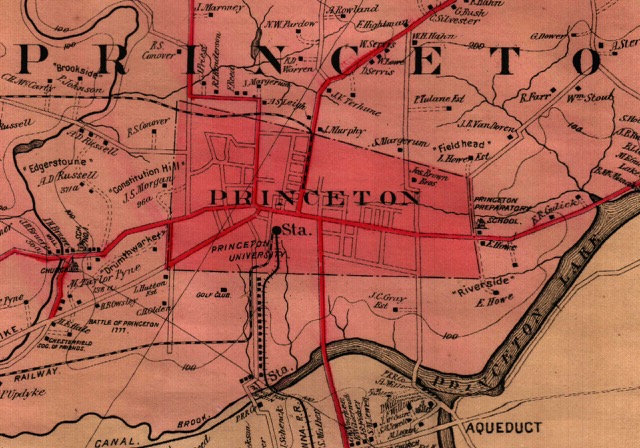
Last comment. This cartographer might simply not be sufficiently detail-oriented to create this map and was more interested in Trenton than the rest of the County. Why would there be a misspelling of “Drumthwarkit” on Figure 6? Robyn Brenner of the Drumthwacket Foundation confirms the mansion never had a second “r” in its name. But “Edgerstoune” is spelled correctly! The many mansions are listed, but “Morven” isn’t shown. Perhaps because it is located within the Borough limits… Otherwise, that’s a curious oversight.