
Collection Gem: February 2020
Authored by: John Allen, johninretirement@gmail.com
When I began this article it was an unseasonably warm 67 degrees Fahrenheit! But at one point New Jersey was in the grip of Pleistocene cold, covered by glaciers up to 10,000 feet thick. Hard to imagine, but perhaps Map 146 (Figure 1) can help. Along with several other maps (two of which were included in Ray Simonds’ Collection Gem of May 2017), this map was an enclosure in the Geological Survey of New Jersey’s 1893 Annual Report.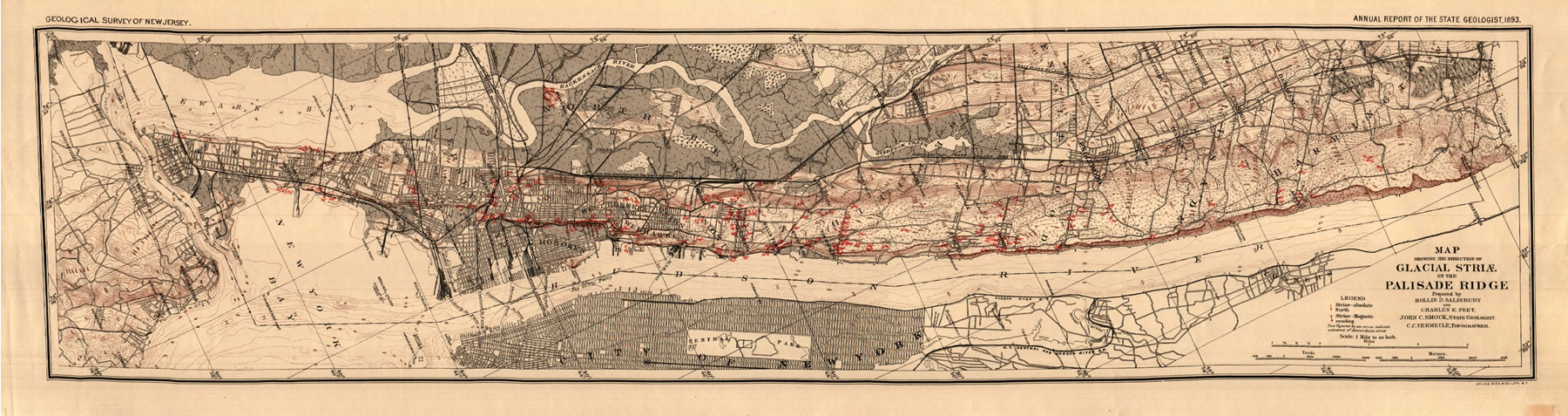
It’s difficult to imagine the Pleistocene world of New Jersey, but some 25,000 years ago the Jersey Shore was well east of its present-day location, and much of the Watchung Mountains was covered year-round by thick ice. Why? Much of the world’s water was bound up in ice, so sea levels were much lower than today. Map 146 indicates the direction of ice flowing across the Palisades Sill, with glacial striations indicating the direction the ice scraped across the area. To leave any trace of that, of course, the ice had to have considerable weight so the sand and gravel incorporated in the ice could gouge the rock it flowed over.
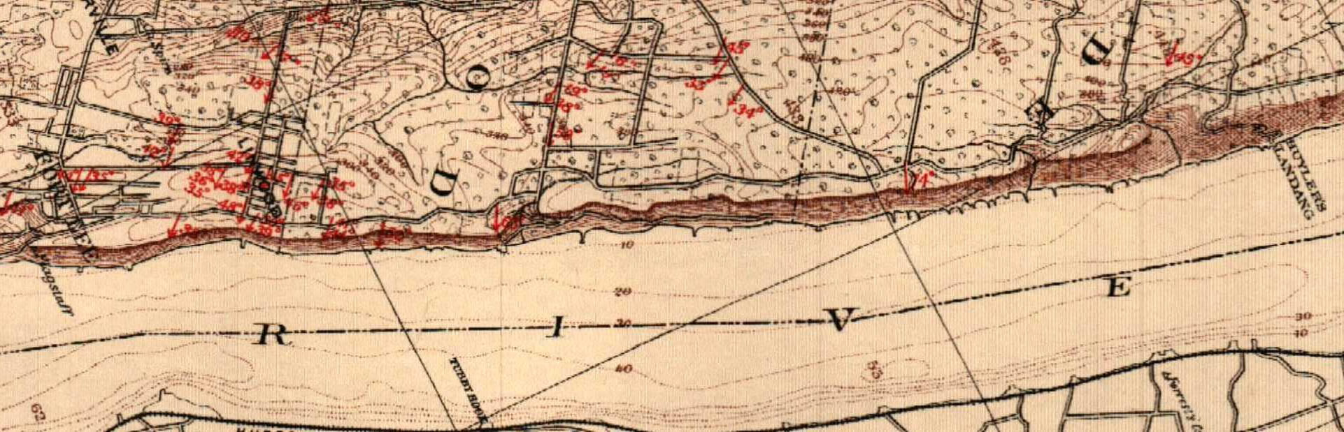
Represented on the map as small red arrows (Figure 2), the numbers are degrees from magnetic south, the striations (oriented in the direction of the arrowhead) indicate the glaciers moved south-southeastward across the Palisades, suggesting the main lobe of ice was to the north and west, putting much of the Watchung Mountains under ice. Once across the Ridge, the ice is believed to have flowed in a more southerly direction, filling what is now the Hudson River channel. The end of the glacier is marked by its “terminal moraine”, where its load of sand and gravel was dumped at the end of what could be viewed as a large conveyor belt. The most obvious remnants of this are Long Island (now you know where Bay Ridge got its name) and Cape Cod.
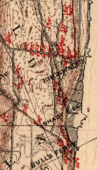
Not into glacial geology? No problem! The map contains some much more recent history as well. For example, Figure 3 shows Huyler’s Landing (north of figure) where the British and Hessian troops crossed the Hudson River on November 26, 1776, marching south and routing the Continental Army holding Fort Lee (south of figure).
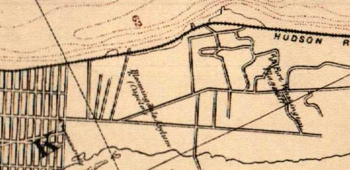
Figure 4 shows the location of what was Fort Washington, which fell to the British and Hessian troops November 16, 1776, and enabled them to assault Fort Lee. Also in the figure, south of the Fort’s location, stood the remains of the Bloomingdale Insane Asylum, which was active from 1821 until an abuse controversy led to its closing in 1889. It is now the Morningside Heights neighborhood, and the site of Columbia University.
Other points of interest might be Bledsoe’s Island which held the completed Statue of Liberty in 1886, and Ellis’s (sic) Island, where the immigration station opened the year before this map was published. Both islands can be seen in New York Harbor (both in New Jersey water, I might add…).
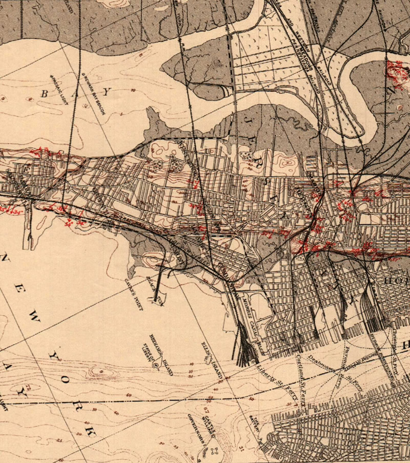
On the New Jersey side you will see Steven’s Point in Hoboken, the location of Steven’s Institute of Technology, opened in 1870. I learned on Wikipedia that Steven’s Institute was the first college in America dedicated solely to Mechanical Engineering, and that two of the Stevens brothers “created America’s first commercial railroad”! Further south (Figure 5) shows the 1836 extension of the Morris Canal (dashed line) into Jersey City’s “Little Basin” from Newark, making it the eastern terminus of the canal. It linked Jersey City with anthracite coal fields of northeastern Pennsylvania and iron ore mines in New Jersey to feed burgeoning industry. The canal was eventually by railroads and and less than 10 years after this map was published, a committee recommended its abandonment in 1902. Today, a shadow of its former self, the Morris Canal Basin is a yacht marina.