
Collection Gem: August 2020
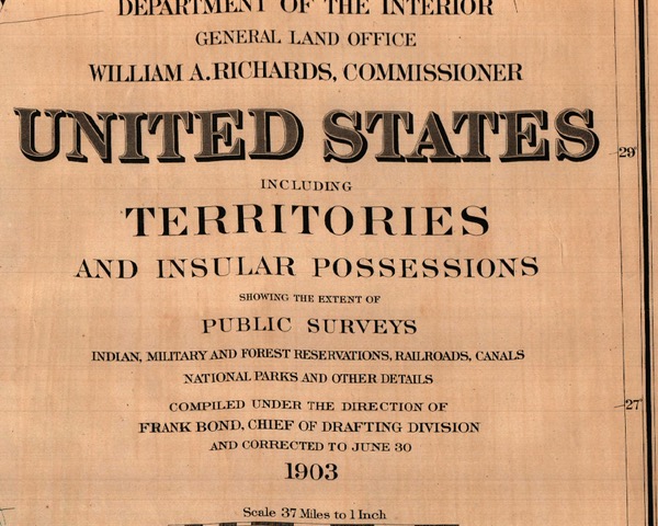
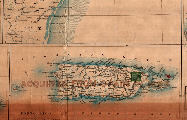
The previous Collection Gem reflected the United States of 1884. This month I share a United States map corrected to June 1903 (Figure 1) and discuss the geographic differences occurring the previous 19 years. Map 20 reflects the growth of the United States resulting from its participation in the “New Imperialism”. The country grew organically as many mainland western and midwestern Territories became States, resulting in an increase from 38 to 45 states. But the US also grew by conquest with the acquisition of Hawaii, Samoa, Guam, the Philippines, Puerto Rico and Cuba. Except for Hawaii and Samoa these lands were ceded by Spain following the Spanish-American War and became American Protectorates. They are annotated as 1898 acquisitions on the map (Figure 2, for example). Hawaii was annexed several years after a coup led by a certain Mr. Dole (familiar name?) while Samoa acquisition was negotiated with the German Empire.
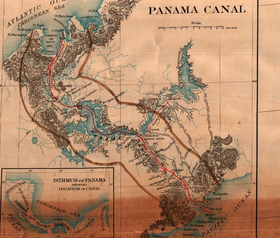
The map also includes the Panama Canal Zone (Figure 3), which was originally the subject of an agreed lease from Colombia in January 1903. But the agreement was not approved by the Colombian Senate, so the Zone was not actually an American protectorate until November of that year.
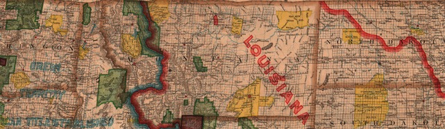
Notice how much smaller “Indian” reservations became in almost 20 years by comparing Figure 4 (yellow) with Figure 2 of last month’s Collection Gem (green color). Note the decreased reservation land provided for Native Americans. Much of what was reserved in 1883 was settled by American citizens or set aside as wilderness or a national park by the US Government. Noteworthy is the “Standing Rock Indian Res.” along the North/South Dakota border, which has been in the news for the past few years regarding the Dakota Access Pipeline dispute. This is not the only reservation making recent headlines.
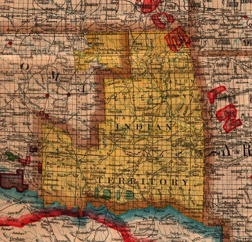
Also compare Figure 5 with last month’s Figure 3 and note the reduction in reservation lands in what is now Oklahoma. On July 9, 2020, the Supreme court upheld the claim of the Creek Nation that a large chunk of Oklahoma remains a reservation for the purposes of criminal prosecutions. This means natives on this land must be tried in tribal or federal, rather than state, courts. Neil Gorsuch, writing for the majority, wrote “Today we are asked whether the land these treaties promised remains an Indian reservation for purposes of federal criminal law. Because Congress has not said otherwise, we hold the government to its word.” Oklahoma had argued it had ended that reservation when Creek individuals were assigned their own farms. But Congress had never explicitly gotten rid of the reservation. The decision holds the federal government to the treaties it negotiated with the Creeks. It has the potential to apply to four other reservations in eastern Oklahoma whose histories are similar to that of the Creek people. Another example of how maps can reflect history, but are also useful in shedding light on current events!