
Collection Gems: September 2017
The Sanborn Fire Insurance Map website says: “Sanborn has been creating maps since 1866—longer than any other company in the United States. We’ve been gathering information and mapping buildings for more than 140 years. Our archives contain over 1.2 million Sanborn maps containing the history of approximately 12,000 American cities and towns.” That’s a really remarkable effort, and a boon for genealogists and historians!
 The Society holds original map sets for Flemington and Lambertville. Specifically, Maps 284 and 285 are Sanborn Maps of Flemington from 1902 and 1896, respectively, and Map 286 covers Lambertville in 1912. The images for this article are taken from the 1902 Flemington map set (Figure 1), being in the best condition of the three sets.
 The key to these maps (on Figure 2) illustrates the degree to which these maps graphically describe each building in the mapped area. And at a scale of 1 inch = 50 feet, they contain lots of detail! Whether a building was brick, frame or stone construction had significant implications for how each would react to fire, thus the interest in these maps from insurance companies. The infrastructure (hydrants, escape routes per floor, wood or metal cornices, metal window shutters, etc.) were used to determine the fire risk and spread potential for each address. But these details are of interest to the genealogist as well. Let’s look at Flemington in 1902.
 Figure 3 — The “Fulper Bros. & Co. Pottery” facility comprised several 1 to 3 floor frame buildings with brick kilns, turning and glazing buildings. The former was a slate or tin roofed brick building of 3 storeys with two windows on each floor, and an 18 horsepower engine. Contrast that with the 1-1/2 storey, frame construction straw shed, with no windows and a shingle roof. (Where would you rather be if a fire broke out?)
 Figure 4 – the 2-floor County Courthouse & Jail were built of stone and had a slate or tin roof. The adjacent prison yard was surrounded by an 18-foot stone wall to the north and south (along Court Street). The west is bounded by the 2 floor brick engine house and in the southeast corner is a 2 floor frame building, perhaps for the prisoners in inclement weather.
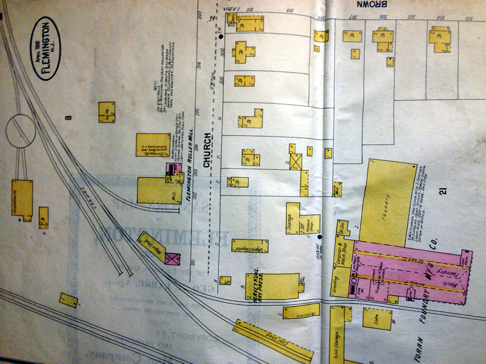 Figure 5 – demonstrates how important Flemington was for the Central Railroad of New Jersey, illustrating the infrastructure needed by the CRRNJ: a turntable, locomotive shed, ice house, wagon and coal sheds. Also illustrated is the spur line that served the Foran Foundry Manufacturing Company.
 Figure 6 – the stone Presbyterian Church with its 60 foot steeple on the southwest corner, with the familiar “Soldiers Monument” on the small patch of land between North and East Main Streets.
 |
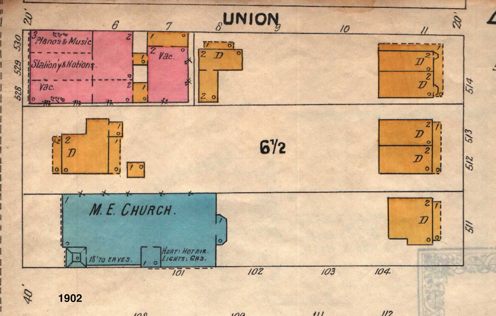 |
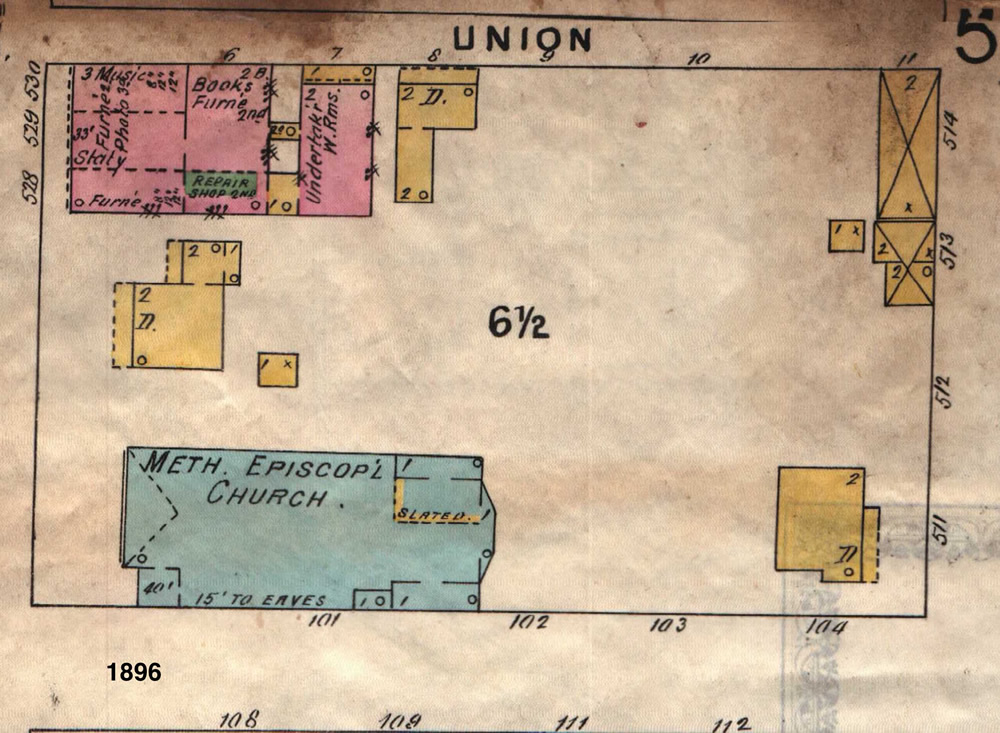
If you visit the Society’s Library to inspect the Flemington maps, be sure to look at both vintages. Despite being only 6 years apart, significant changes took place, as illustrated by the comparison of Figures 7 (1896) and 8 (1902), cropped images of the area bpunded by Main Street on the west, Union (now Chorister Place) on the north and Spring Street on the east. The Historical Society’s Doric House is the yellow (frame) dwelling (“D”) near the left margin. Interestingly, the Choir Building contained undertaker work rooms in 1896! The building was vacant on the 1902 map. The Choir was founded in 1895, but apparently didn’t occupy the building until after 1902. The west side of Spring Street saw two duplex buildings (4 dwellings) built during these 6 years! Quite a change clearly documented in just a few short years!