Collection Gem: January 2019
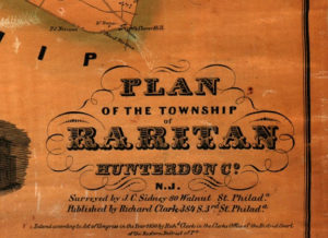
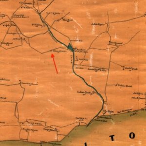
Maps reflect history, and people are the players on history’s stage. In this Collection Gem I use Map 51, an 1850 “Plan of the Township of Raritan” (title block in Figure 1), to learn about a couple residents – and buildings – of the time. Some will be familiar to you; others, not. One name that might be familiar is Adam Bellis, whose ancestors were among the first settlers in the area. Adam Bellis along the “Nachanic” River (arrow on Figure 2) may be descended from the Adam Bellis memorialized on the Historical Marker along Kuhl Road (figure 3), between SR31 and Reaville Road. My suspicion is that Wm. Bellis shown on the map may be descended from him, too. And a close look at Figure 2 will give you a good idea why it’s called Kuhl Road.
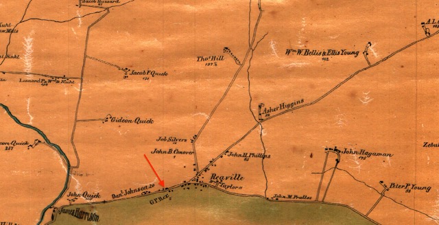
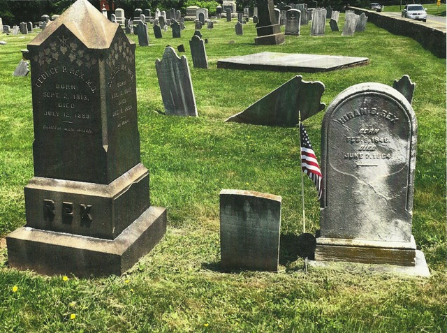
A name you might not recognize is “G. P. Rex” of Reaville (arrow in Figure 4). That’s too bad, because he’s a fascinating individual with a remarkable story. The photograph in Figure 5 shows his headstone in Pleasant Ridge Cemetery on Old York Road (also visible in Figure 2) and that of his son Hiram, marked with an American flag. The story, as told in John Kuhl’s thorough book “Hunterdon County in the Civil War”*, is that George Rex was a physician who moved from Raritan Township to Perry, Illinois in 1856. When the War broke out he enlisted as regimental surgeon in the 33rd Illinois Regiment. One son, Oliver, was his assistant surgeon in that regiment. George advanced to Division Surgeon and Medical Director before the War ended, spent several years living in Selma, Alabama, and returned to Reaville in 1871 where he is shown living in the 1873 Beers Raritan Township map. He died in 1889.
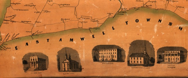
Instead, let’s look at the building illustrations in the Township in Figure 6 (recognizing that Flemington was part of Raritan Township in 1850). Three of the buildings still stand: the W. P. Emery store on William Street and Baptist Church on Main Street, both in Flemington, and the Presbyterian (now Non-Denominational Christian) Church at Reaville. (Noteworthy is the fact that this Church was moved to its present location in 1839, from its original location near the cemetery of Figure 4). The Union House was replaced by the Union Hotel in 1878 which stands vacant on Main Street in Flemington. The Hugh Capner House stood on the property where the St. Magdalen di Pazzi Roman Catholic Church now exists. (Thank you, Dave Harding, for confirming that!) Three buildings are illustrated along the map’s top margin: the Lyceum, the Presbyterian Church (a previous incarnation that is unlike the present Church which was built in 1857), and the County Court House, still standing since its construction in 1828. When you next visit the Society’s Deats Library take a look at Map 51, and enjoy a walk around Flemington to see several of the illustrated buildings! (Warning: a lot has happened in 170 years, so these buildings look very different).

