Collection Gem: February 2019

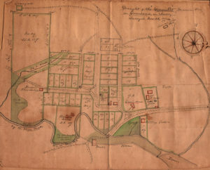
Map 223 (Figure 1, stitched thanks to Bob Leith) is entitled “Draught of the “Gemein Ort”/Moravian Town in Greenland in Jersey Surveyed Nov 26, 1774”. The Society has three copies of this survey map (Maps 222, 223, and 224), two of which are tracings and one of which might be an original, although Lehigh University’s “Hidden Collection” of drawings and prints has what is undoubtedly an original titled in German (“Grund Riss von dem Gemein Ort auf Greenland in der Jersey ausgelegt den 26 November 1774”). The scale is 1” = 10 Ruthen, a pre-metric Prussian measure approximating an English Rod of 16 feet. Our maps are titled in English, with distances and areas measured in feet, acres and perches (“p” on the map).

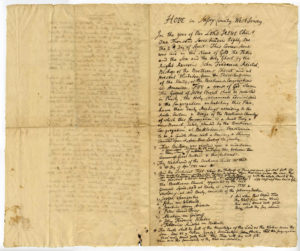
Not only does the Society own three copies of the map, but in Manuscript Collection26, Box 8, Folder 352 Bob Leith found a letter memorializing the purchase of the tract (Figure 2).
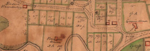
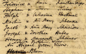
Three early settlers of the land were John Samuel Green, Francis Blum and Frederic Rauschberg, whose buildings are shown in red and labeled on the map (Figure 3), and whose names are included on the Memorandum (Figure 4). For more on Green, CLICK Goodspeed Histories / Samual Green.
My understanding is that a “Gemein Ort” was a settlement meant for believers of the Moravian faith. Greenland, so named after the aforementioned John Samuel Green, was officially accepted by The Moravian Church after it was surveyed, and on February 8, 1775 the name was changed from Greenland to Hope, the new name being derived from the “hope of immortality” of the early Moravian settlers. This name change was done by drawing lots, and is specifically mentioned in the Memorandum (Figure 5).


After almost 40 years of the Moravian “experiment” in Warren County, the community was sold and nearly all Moravians returned to Bethlehem or Nazareth, Pennsylvania. The main reason for closing the community was that it was never self-supporting and had declined from its height of population of 147 to under 100 people by the early 1800’s. The congregation’s last act was the service of worship in the Gemeinhaus on Easter Sunday, April 17, 1808.
Vestiges of the old settlement still remain. The Hope Moravian Cemetery is the modern incarnation of the graveyard on the map. The Facebook page of the Hope Moravian Cemetery states the earliest dated marker is 1768. The mill – dating to 1769 – still stands (now the Inn at Millrace Pond), as does the Moravian Church (now the Bank of Hope). The Hope Historical Society has a museum and offers brochures for a self-guided walking tour of the Village, a State and National Historic Registered district. CLICK here for more information.
The Moravian faith has a rich history in Colonial America, and there were established communities in many of the colonies, as far afield as Salem, NC. There were also Gemein Orts in both Lititz and Emmaus, PA the latter of which is marked with an historical marker. CLICK to view here.
