
The Beers Atlas – The Way It Was Meant to Be Seen!
 For the first time in over 150 years, the Beers Atlas has been reprinted in color with all the maps of the original 1873 edition. This definitive edition also includes an enlarged 18 ½- X 25-inch fold-out map of Flemington.
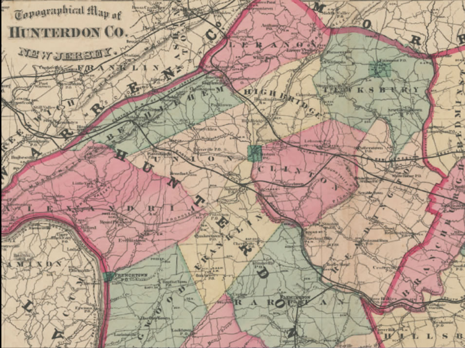
What’s so special about the Beers Atlas? Far from the modern, impersonal style of map-making, the 1873 Beers Atlas details every stream and hillock, and shows the specific location of many homes, schools, businesses and farms. The map points out the location of where many of the families in Hunterdon County lived. There are maps for every town within the county and maps of a number of villages within the county. Whether you have an old home in Hunterdon County, family ties here, or an interest in local history, you will love this new edition. And because of their precision and fine detail, these maps are an indispensable guide for anyone researching Hunterdon County.
 This is the first reprint of the Beers Atlas that contains all the maps of the original 1873 release and in color. This soft-cover edition will make a welcome addition to your home library.
For a limited time, we are offering this soft-cover edition for $50, plus shipping (which runs about $9) – this is the same price as the 1987 reprint edition. You can order securely online HERE or by sending a check to Hunterdon County Historical Society, 114 Main Street, Flemington, NJ 08822. You can always pick up a copy at our Hiram Deats Memorial Library Tuesday (except the second Tuesday of the month) or Thursday afternoons from noon to 4 p.m. or call us at 908-782-1091 to arrange a time to pick up your atlas.