
Collection Gem: January 2021
Authored by: John Allen, johninretirement@gmail.com
The usefulness of the Map Collection was once again apparent in a recent episode. You might have noted the article on the redesign of the Deats/Thatcher Archeological Collection in the Society’s Fall 2020 newsletter. During this on-going exercise it was noted that one group of artifacts was recovered from “the Polhemus Farm”. Excellent! Except we didn’t know where the Polhemus Farm was located. How could its location be determined?
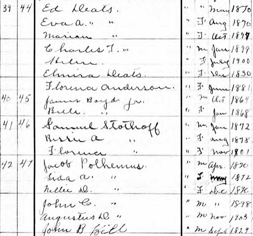
Realizing the Society Map Collection holds several copies of a 1902 vintage Hunterdon County map, and with the knowledge that Hiram Deats lived in Flemington Junction at the turn of the 20th Century, I visited a subscription-based genealogical website and learned that an “Ed Deats” lived very close to a Jacob Polhemus in the 1905 New Jersey state census (Figure 1). Both men were farmers. Deats’ artifact collection was acquired between 1880 and 1895, and the map dates to 1902 so the 1905 State census is pertinent. Worried that “Ed Deats” was not our Hiram Edmund Deats, I had some checking to do. His spouse was Eva Taylor; the census shows Ed’s spouse was “Eva A.” Deats’ birth year was 1870. The census shows “May 1870”. Hiram was also a Junior, so he might very well have been referred to as Ed to distinguish him from his father, Hiram Senior. And “Jacob Polhemus” was the only head of household by that surname in Raritan Township. While not certain, it looked very likely to be on the right trail.
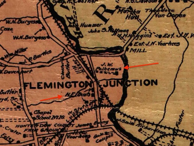
Map 66 was pulled from storage in the Archive Building. The Raritan Township portion of the map was searched for a Polhemus. What I found is captured in Figure 2. Notice the two names delineated by arrows: “J. W. Polhemus” and “H. E. Deats”. These men were neighbors and surely were well acquainted. I believe them to be Jacob and Hiram (Ed). More evidence came from a 1917 map published as Bulletin 18 of the Geologic Series by the New Jersey Department of Conservation and Development, with the title “Archaeology of Warren and Hunterdon Counties” by Max Schrabisch. It contains a map of Schrabisch’s study area and identifies camp and village sites as they were established by the artifacts recovered.
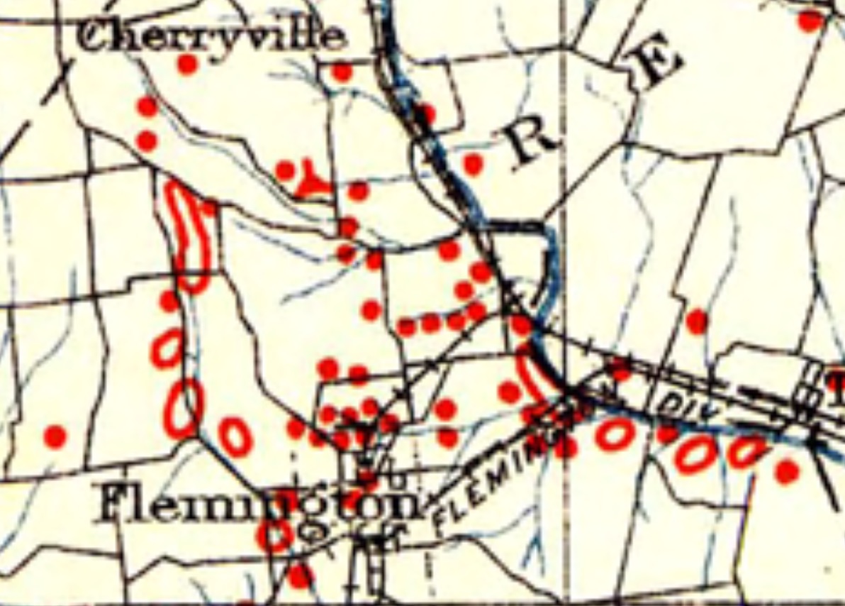
Figure 3 is the Flemington Junction part of that map (sorry for the “fuzzy” screen grab) and illustrates the many sites recognized in the Junction area. One of our Native American collectors said: “The Polhemus farm sits up above the flood plain…, on the bend in the river, backed by a fresh flowing creek on its southern border. You can’t get a more ideal location!” That’s good enough for me.
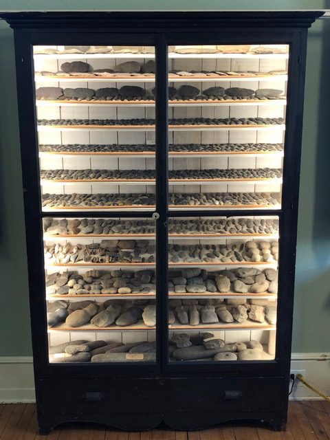
Figure 4 will provide a sense of what the “final” cabinets will look like when lit. After perhaps a century, the cabinet is lit and its contents are more visible than previously! It’s an exciting time, and the Society thanks the team behind the effort: Mark Zdepski, Greg Herman, Ed Fimble, Roger Ahren, and Ben Brandner.
More about the Collection can be found on page 1330 of the Spring 2020 newsletter and on the Society’s website.